
Lukla to 1st Teahouse

Lukla airport is said to be one of the most dangerous airports. The runway is short, and the weather temperamental. When we landed we felt the urgent catch of the brakes as we quickly came to a stop.

Ambrose stands to the side of the path as a group of Dzo carry supplies back to Lukla. Dzo are a hybrid of cattle and yaks and can be found commonly in the lower altitude regions of the Everest valley.

Ambrose waits near the painted Mani stones and Chortens to direct us around the stones clockwise. We pass the rocks on the left and can repeat the mantra, Om Mani Padme Hum.
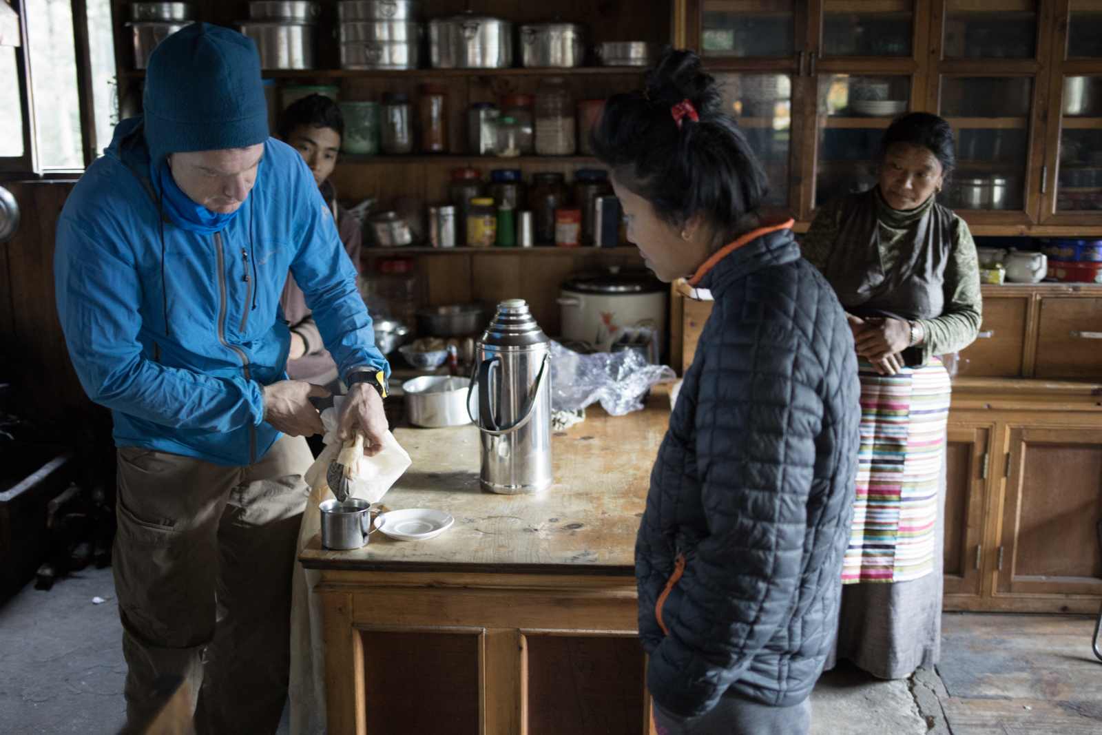
Our hosts at the Kongde Peak Guest House saw Ambrose making a cup of coffee and they asked to learn how to make an American-style cup of coffee so they could use the beans a previous guest left behind. We found a silken piece of cloth to act as a filter and he poured a wonderful cup of coffee. Our hosts laughed and declined a taste. They thought it was funny how strong we liked the coffee.
Namche Bazar
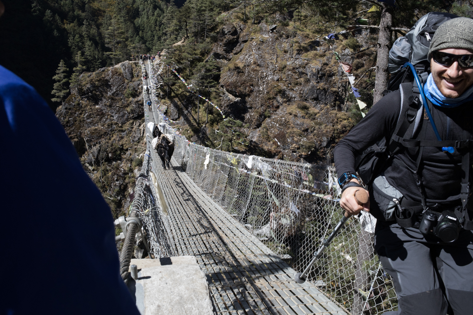
A trekker smiles as he crosses the bridge to the solid ground. Two Dzo (cow/yak hybrids) began running across the bridge and gave him quite a fright.

The Larja Bridge crossing. Two bridges gap a wide valley above the Dudh Koshi Nadi River.

Prayer flags fly in the wind with Kongde Ri in the background.

A small sheep grazes on some grass growing on the platform of an older Stupa. Namche Baazar, Nepal.

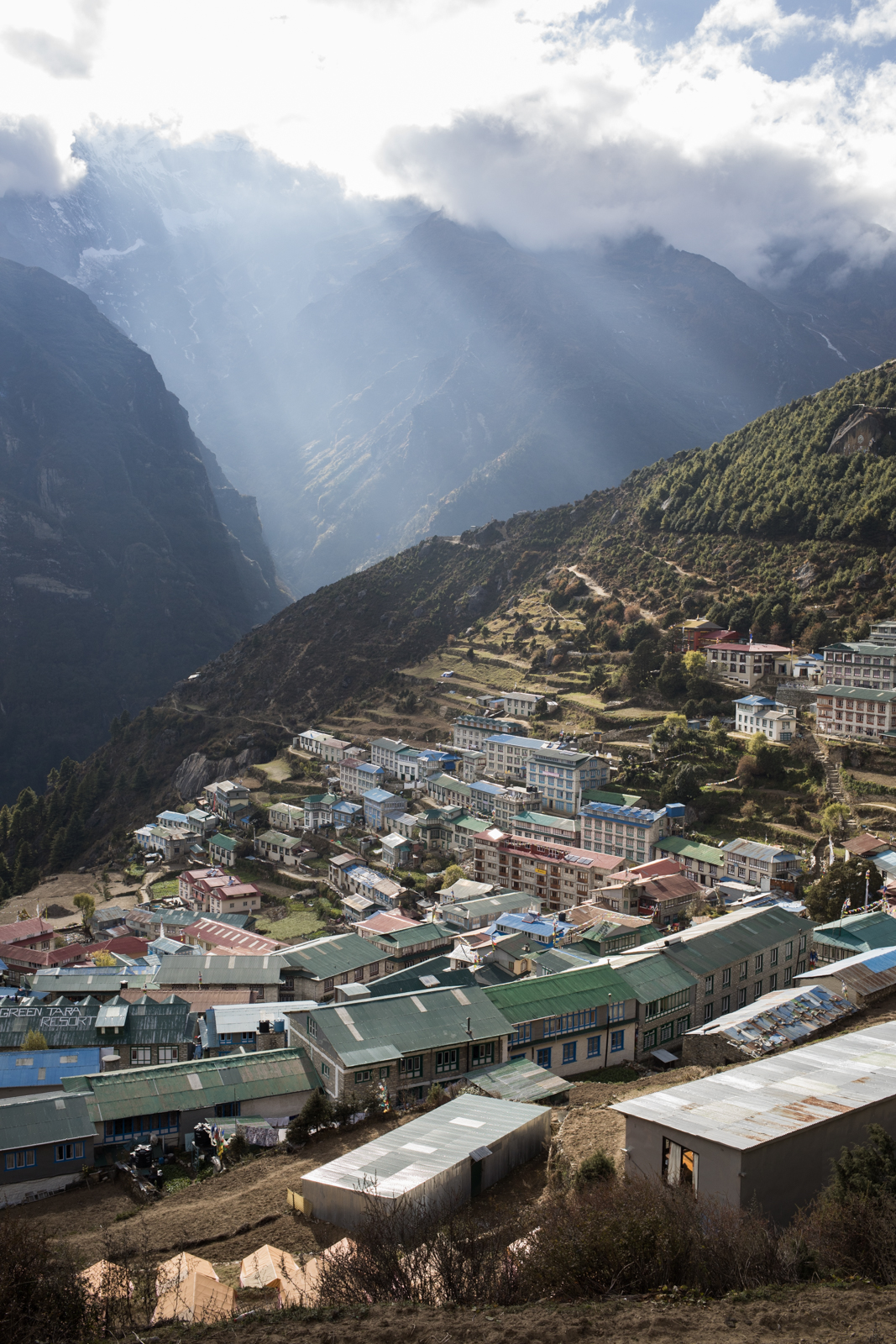
When you enter the village of Namche Baazar you are greeted with an incredible view of the peaks of Kongde Ri and a Stupa at the center of the community. Namche Baazar is a key trade town in the Everest valley. The village sits at 3,440 m.

Stars over Kongde Lho 6,187 m / 20,299 ft, Nepal. (Elevation credit: PeakFinder)
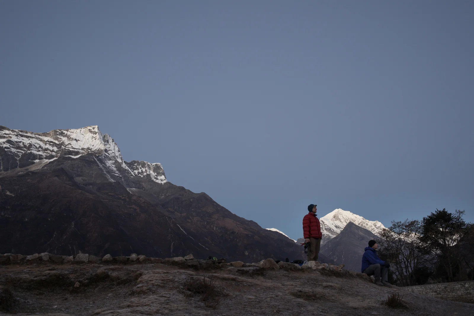
Ambrose and Russ watch the horizon as the sun rises and brings light to the Everest valley.

Alpine glow. Left to Right: Taboche 6,495 m / 21,309 ft, Nuptse 7,861 m / 25,791 ft, Everest 8,848m / 29,029 ft, Lhotse 8,516 m / 27,940 ft, Shartse 7,457 m / 24,465 ft Ama Dablam 6,856 m / 22,493 ft. (Elevation credit: PeakFinder)

Left to Right: Taboche 6,495 m / 21,309 ft, Nuptse 7,861 m / 25,791 ft, Everest 8,848m / 29,029 ft, Lhotse 8,516 m / 27,940 ft, Shartse 7,457 m / 24,465 ft. (Elevation credit: PeakFinder)

Kongde Lho 6,187 m / 20,299 ft. (Elevation credit: PeakFinder)

Tengi Ragi Tau Se 6187 m / 20299 ft. (Elevation credit: PeakFinder)

Our group photo in front of Everest.

Pemba Yenji Sherpa delicately arranges burning embers below juniper branches during the last moments of sunrise in Namche Bazzar, Nepal. The branches are burned as incense for good luck.

Thamserku 6,608 m and Kusum Khangkaru 6,367 m above Namche Baazar, Nepal. (Elevation credit: PeakFinder)

A group of young men look out over the village of Namche light breaks through the clouds.
Clouds over Kangde Lho begin to break up as the evening light shines down on the village of Namche Baazar.

A group of young kids gathered together on the outskirts of town to pay music for a small group of locals. I ran into them as I returned from an acclimatization hike. They had mics, electric guitars and were holding each other as they sang.

Our guide Lakpa Sherpa and his son Wanda Sherpa.

Yak rest along the upper road near Namche Baazar.

Prayer flags fly high on a ridge over Namche.
Namche Bazaar to Doboche

After an acclimatization day in Namche Baazar, we began our trek towards Doboche. As we hiked, we walked towards the mountains and made our way further and further into the valley.

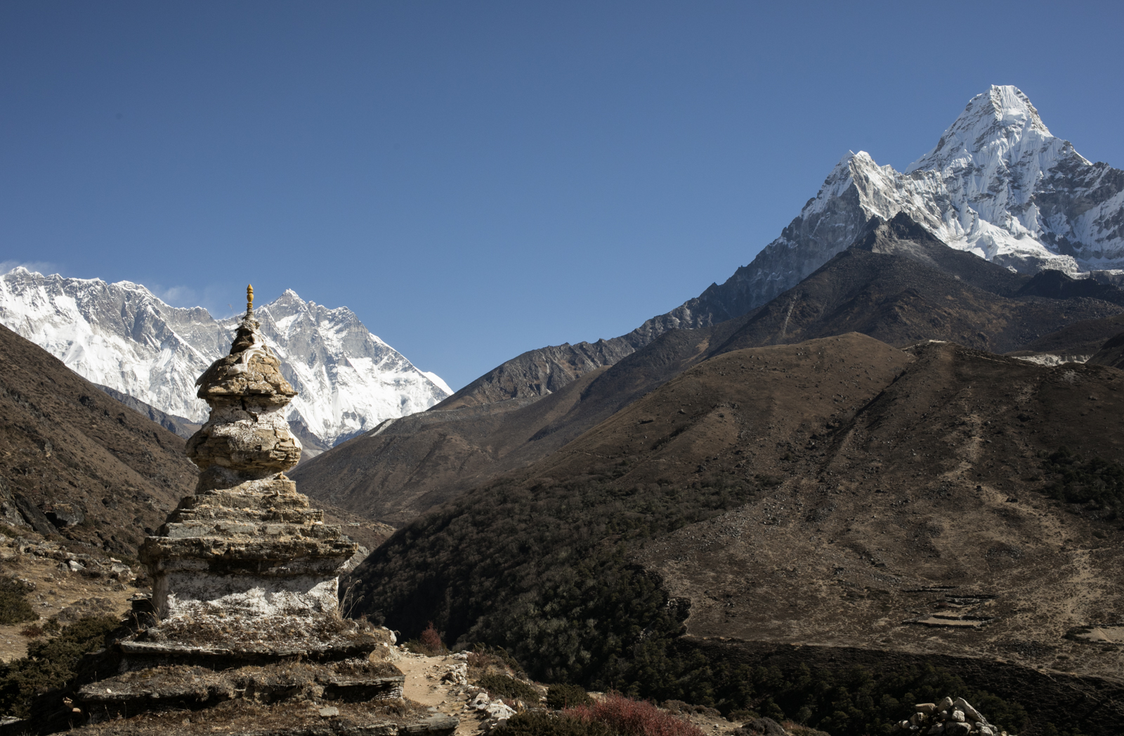
A view of the mountains around a carves stupa.

Left to Right: Taboche 6,495 m / 21,309 ft, Nuptse 7,861 m / 25,791 ft, Everest 8,848m / 29,029 ft, Lhotse 8,516 m / 27,940 ft, Shartse 7,457 m / 24,465 ft Ama Dablam 6,856 m / 22,493 ft. (Elevation credit: PeakFinder)

During this section of our hike we encountered large crowds leaving Namche. We would trek along the hillside before climbing down and up another river valley where we would cross a rhodedendren forest before reaching Tengboche.

As we hiked higher in elevation, the pack animals changed from the cow-yak hybrid Dzo, to yaks. A group of yak carry supplies through the Tengboche village in front of the renovated Tengboche Monistary.

Monks sift pigmented sand in delicate lines to slowly create a mandala. During our visit to the monastery, we had the privilege of attending a session of prayer where we sat while the monks chanted prayers and prepared offerings. We presented a silk kata to the Head Lama of the monastery and he blessed us for our continued journey by placing a small piece of wood on our heads and draping the silk around our shoulders. We sat and listened to the chants. The chamber where the monks prayed had hundreds of beautifully painted frescos and thousands of delicately carved images in the wood panels that made up a tiered sculpture in the center of the room. We stayed maybe half an hour and it wasn't enough time to take in all of the beauty.

Grain by grain the mandala is formed. The work of art is an act of meditation. A ceremony had been scheduled two weeks out to sweep away the image and celebrate with the community. A temporary beauty. Our guide said that many people would come to the monastery for the ceremony and dancing.

Tengboche Village panorama.

A young dzo is led to a straw barn to stay warm for the evening.

Ama Dablam. Ama Dablam 6,856 m / 22,493 ft. (Elevation credit: PeakFinder)

Star Trails. Ama Dablam 6,856 m / 22,493 ft. (Elevation credit: PeakFinder)
Doboche to Dingboche

Imja Khola river with Ama Dablam in the in the background.

I'm a pretty slow hiker. Ambrose and Russ typically hiked ahead of me and waited periodically for our group to come together. Our guide Lakpa was typically in my line of sight to make sure I didn't fall too far behind. At one point we were hiking through a very small village and I hiked past Lakpa as he was talking to someone. I met up with Russ and Ambrose and we waited. Eventually, we backtracked to find our lost guide. When we met him, he said that he had run into his brother in law and that we should join him for tea. What was a quick stop turned into one of the most fascinating conversations I've ever been a part of. Lakpa's brother in law is Khenpo, a high rank of Lama and does Tibetan text translation and Nepal Studies at Harvard. We sat for three hours as he let us ask him questions about Buddhist Philosophy and history. His travel companion, Ariel Lewin, was doing research for a book about how people traveled through the Everest valley, a spiritual and geographic history. We sat and drank yak butter tea as we spoke about compassion, morality, energy transfer, powerful thinking, giving up selflessness, connecting with loved ones to exchange compassion, how belief should be based in logic, and many more topics. Lakpa Sherpa, Ariel Lewin, Khenpo Sangye Sherpa, Rusty Southwood, Kaylyn Messer, Ambrose Bittner.

A large Mani stone looks over the Imjatse Valley. Mist rolled into the valley obstructing the views of the peaks as we hiked, but we still felt small among the foothills flanking the mountains. At this point, we were at the elevation of Mount Rainier. Hiking in the bottom of a valley at 14,000 feet was quite an experience.
“Mist rolled into the valley obstructing the views of the peaks as we hiked, but we still felt small among the foothills flanking the mountains. At this point, we were at the elevation of Mount Rainier. Hiking in the bottom of a valley at 14,000 feet was quite an experience.”

Thamserku 6,623 m / 21,729 ft (Elevation credit: PeakFinder)

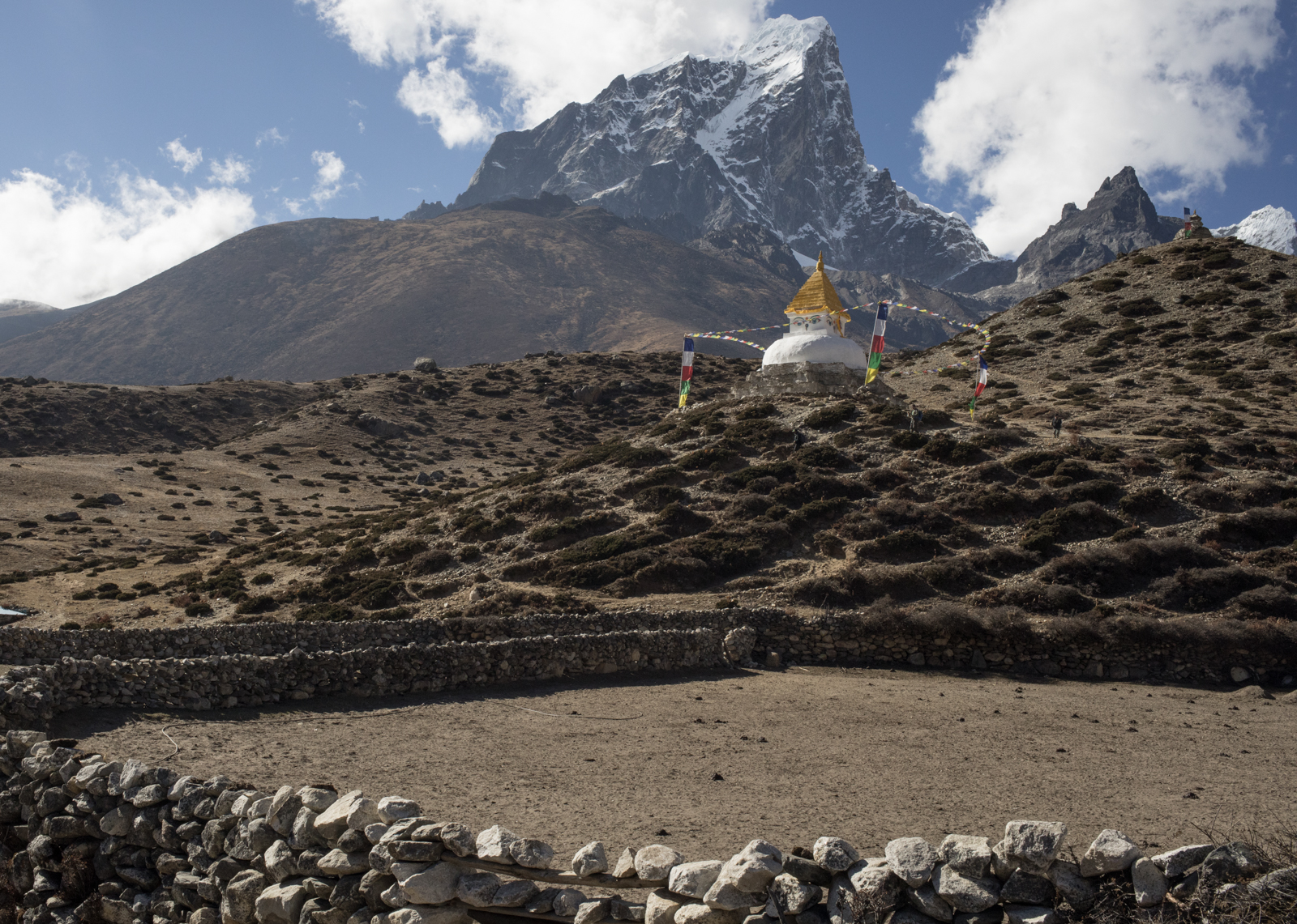
Taboche 6,495 m / 21,309 ft. The village of Dingboche which sits at an elevation of 14,410 ft. We took a rest day to acclimatize to the elevation gain and the altitude. I was beginning to feel some effects of altitude, a slight headache, and a little nausea. I made sure to rest a lot during our stay at Dingboche. Rest, hydration, repeat.

Stupa in Dingboche. The eyes of Buddha are painted in the four directions. The eyes are all seeing and wise.
Rocks are stacked without mortar to create fences to contain yak during the night after grazing and to outline yards around homes. You can see a patchwork of trails made by yak leading up to the Stupa and beyond to their grazing areas. Taboche 6,495 m / 21,309 ft.

As clouds roll in for the evening a final touch of light spreads across the peak of Lhotse. As part of the acclimatization process, we would stay in Dingboche for a day to allow our bodies to get used to the elevation. We would take short walks to allow our bodies to acclimatize in movement. I walked to the ridge at night to watch the sunset. LtoR: Lhotse 8,516 m / 27,940 ft, Shartse 7,457 m / 24,465 ft, Island Peak 6,189 m / 20,305 ft.

Russ Southwood with Prayer Flags. He pauses a moment from taking photos to enjoy the sunset.

Walking back to our teahouse. Left to Right: Lhotse 8,516 m / 27,940 ft, Shartse 7,457 m / 24,465 ft, Island Peak 6,189 m / 20,305 ft, Cho Polu 6,735 m / 22,096 ft (Elevation credit: PeakFinder)
Dingboche to Loboche

While on the Everest Base Camp Trek you rarely get a day where you hike along a flat section for more than a few minutes. However, today our hike started out as a simple ridge traverse. The views were stunning as we hiked above the village of Pheriche. Left: The sharp double peak Kangtega 6,779 m / 22,241 ft, and to the Right: Thamserku 6,623 m / 21, 729 ft.

A porter carries duffel bags for guests. Taboche 6,495 m / 21,309 ft.

Our leisurely hike along the ridge slowly became a climb. We stopped for tea and then began the assent. Left to Right: Taboche 6,495 m / 21,309 ft, Cholatse 6,440 m / 21,129 ft.

Peace, mountains, and sunshine. Russ Southwood, Ambrose Bittner, Lakpa Sherpa, and I enjoyed some tea and cookies before beginning our climb. Village of Dughla.

After a long and steep ascent, we stopped to rest at the top of Thokla Pass. Here, stacks of stones, placks, and tombstones were placed in memory of climbers who died in the mountains. We walked among the memorials quietly.
When I researched this view of Peak Finder, I could only find the names of several peaks. Left to Right: Ama Dablam 6,856 m / 22,493 ft, Tsuro Ri 6,168 m / 20,236 ft, Melanphulan 6,571 m / 21,558 ft, Kangtega 6,779 m / 22,241 ft, Thamserku 6,623 m / 21, 729 ft.

Ambrose Bittner. Taboche 6,495 m / 21,309 ft, Cholatse 6,440 m / 21,129 ft.

The Khumbu Glacier streches down the valley with small braided rivers flowing with silty white water. Left to Right: Chumbu 6,859 m / 22,503 ft, Pumori 7,161 m / 23,494 ft, Lingtren 7,161 m / 23,494 ft, Khumbutse 6,636 m / 21,772 ft, Nuptse 7,861 m / 25,791 ft.

Resting prior to trekking along the glacial moraine.

Pumori 7,161 m / 23,494 ft

Hiking atop the rocky glacial moraine we could see farther down the valley. The proximity to the glacier quickly dropped the temperature. We could see small patches of ice peaking out from the gravel. Left to Right: Chumbu 6,859 m / 22,503 ft, Pumori 7,161 m / 23,494 ft, Lingtren 7,161 m / 23,494 ft, Khumbutse 6,636 m / 21,772 ft, Nuptse 7,861 m / 25,791 ft.

The world is a small place. I was on a short acclimation hike near Lobuche and ran into a fellow Washington Alpine Club member. Scott and I hiked together as I tried to get my body adjusted to the altitude.

A porter tries to get cell phone reception from atop the glacial moraine.

Sunset Light Study #1.
Left to Right: Pumori 7,161 m / 23,494 ft, Lingtren 7,161 m / 23,494 ft, Khumbutse 6,636 m / 21,772 ft, Nuptse 7,861 m / 25,791 ft.

Sunset Light Study #2.
Left to Right: Pumori 7,161 m / 23,494 ft, Lingtren 7,161 m / 23,494 ft, Khumbutse 6,636 m / 21,772 ft, Nuptse 7,861 m / 25,791 ft.

Loboche. After 7 days of trekking, my two changes of clothes became a bit rank. Without taking into consideration the temperature, I attempted to wash one change of clothes and some extra socks and underwear in the cold, cold river. My fingernails were purple as I scrubbed away a week's worth of perspiration. I hung my clothes in vain to attempt to dry them. In the end, I collected the slightly frozen items and placed them in my room for the night. In Loboche the temperatures dropped to the point that we had to knock the ice off of the toilet rim before sitting down.
“Today I had to make the difficult decision to descend the valley without making it to Kala Patthar or the Everest Basecamp. The trek has been amazing, but my body just wasn’t adjusting to the altitude as well as I had hoped. I spent an extra day in Lobuche, 4910 meters, hoping my headache would dissipate so that I could continue up the valley, but it did not. Thank you all for the love and support you have sent me while I’ve been on this trip. Despite not making it to Basecamp, I’ve had an incredible time and I’ve been inspired every day by the epic views and wonderful people we’ve met. Here is a 360 photo standing on a ridge next to a glacial moraine of the Khumbu Glacier near Lobuche, Nepal. Lots of love, Kay”
Loboche to Pheriche

The trek home. While in Loboche I began showing signs of being impacted by the altitude. I had woken up around 3am with the worst headache of my life. I was nauseous. I knew right away that I would not be hiking farther. I cried. The rest of my group continued up to Kalapatthar and to the Everest Base Camp. I stayed in Loboche and began taking Diamox. I had hoped I would get better. I tested my oxygen level and it was steady around 74. The lowest dip it took was to 65. Not a good sign.
I met one of our porters and began the trek down the valley. The best way to treat altitude sickness is to go down. We walked slowly. My headache persisted for a while but began to reduce quickly as we approached Pheriche. Later that day, I met Russ and Ambrose as they returned from their trip to Kalapatthar. I was feeling better.

Porters become sillhouetted as the sun moves behind a peak.

A small helicopter can be seen in the far right. Pheriche is the location of the nearest clinic with tools to treat altitude sickness. While I was there, three separate helicopters brought in ill trekkers.
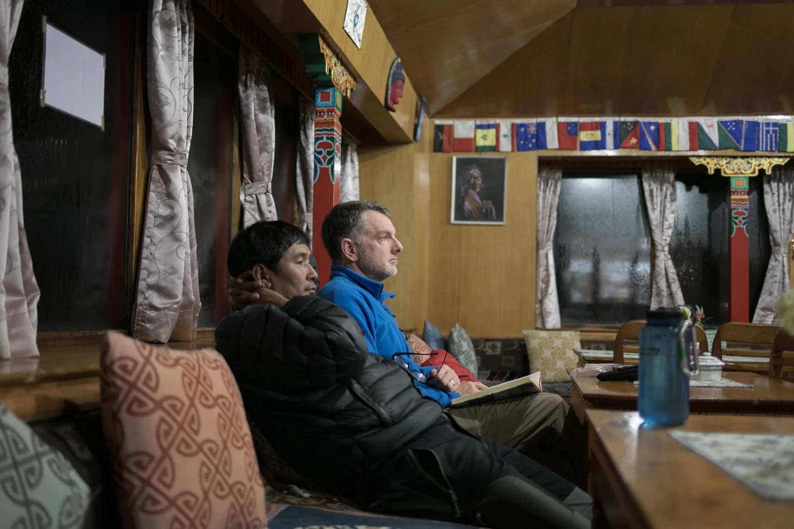
Content exhaustion. Many of our evenings were spent in the communal areas of tea houses. We sat together and talked about the day, the sights and experiences. We ate together and often spent time reading. Trekking at altitude is a slow process. You hike at a speed to allow your body to adjust to the elevation, and you rest often.
Pheriche to Phortse

On our return journey, we hiked along the less traveled side of the Imja Khola river from Pheriche to Phortse. The trail is more narrow and provide some exposed views of the steep valley below. .

A small farm house with rock fence pastures.

The same small farmhouse with a view up the valley.
An old stupa is aged by the weather. On this side of the valley the landmarks feel ancient, as though it was less touched by tourism and more in line with what the local people created for themselves.
Villages below the trek.

Pangboche Gompa. A woman digs and sorts potato from a small elevated garden behind the monastery. We were near the end of the farming season so many people were left with root vegetables and some hardy greens.
In the Pangboche Monastery, you can view what is claimed to be the dried hand of a Yeti. The hand was long with red hair and long fingernails. There are many stories of the yeti in the Everest valley.

Stone carvings. Mani stones.

Stone carvings. Mani stones.

Traversing along a narrow path high on a steep slope. The trail looked like a thin scratch following the landscape.

The view down the valley.

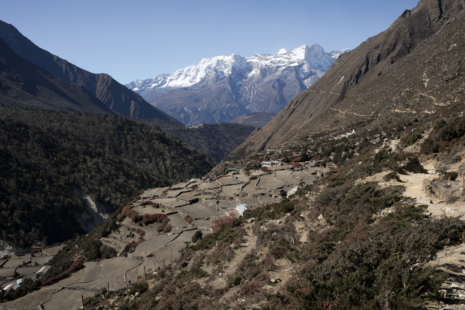
The village of Phortse.

In Phortse we stopped to visit a farmer who welcomed us into our home. She fed us boiled potatoes that we peeled and dipped into a spicy sauce with some green herbs. It was delicious and quite fun to peel apart the still steaming potatoes. She had plastic tubs of homemade rice beer called Chaang. It is thick and has the look of an off-white milk. In Nepal, Chaang is fermented from the local grain. You can find it made from rice, barley, millet. When a host offers you a cup, you should be prepared to drink several refills as it is custom for the host to offer many glasses as a show of generosity. Our porters, Baun and JP, joined us. JP is 25 with two daughters, and Baun is 31 with three sons. They have been working as porters since they left school. Their speed was amazing and we rarely saw them while we hiked.

Children returning from school peer through the windows watching us eat potoatoes.

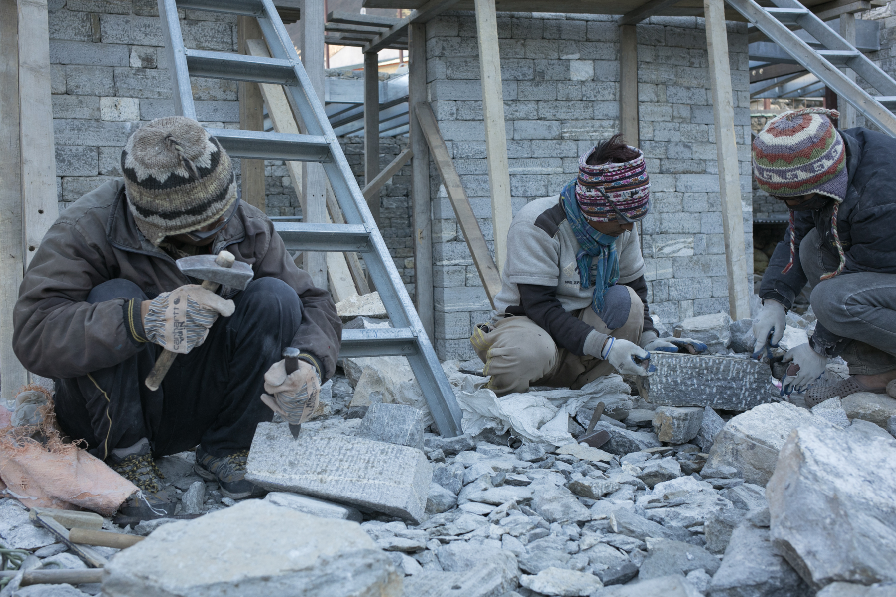
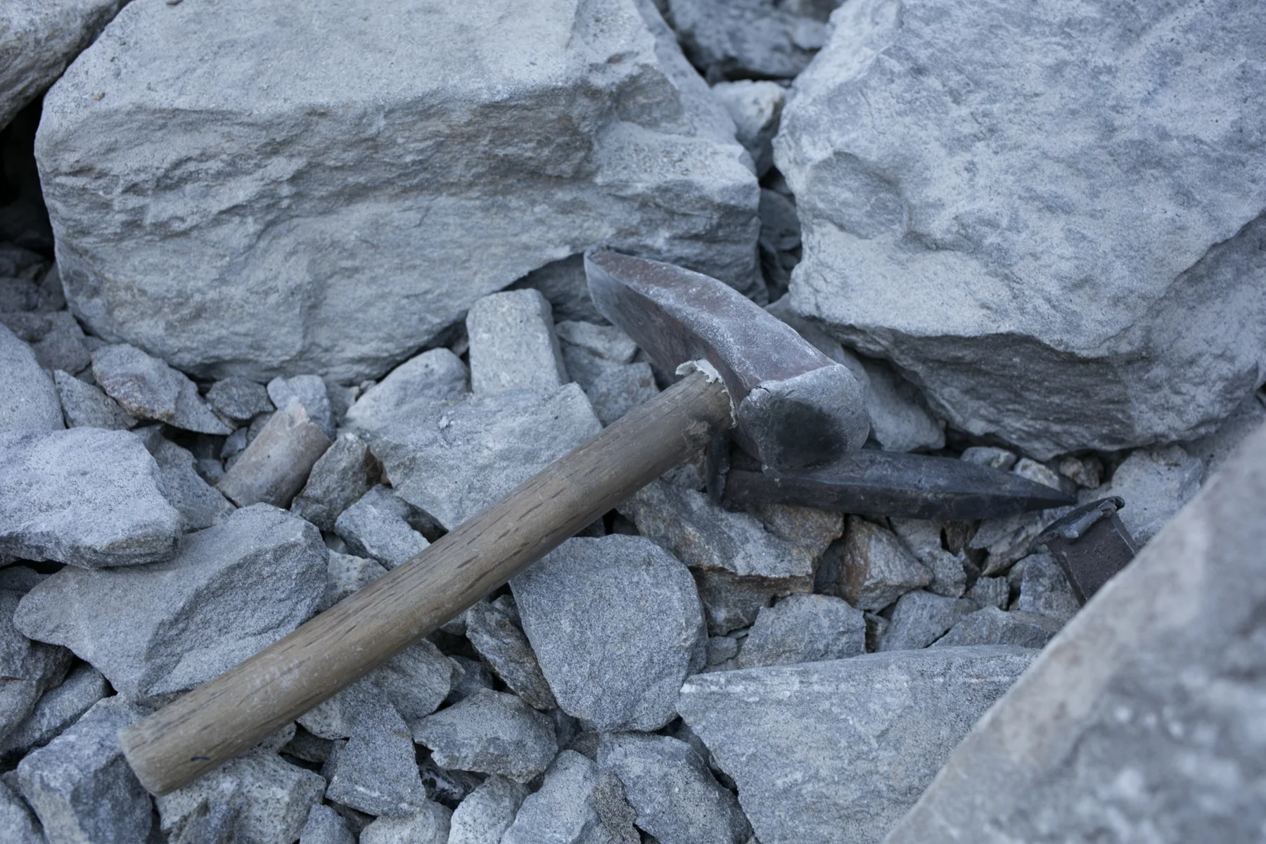
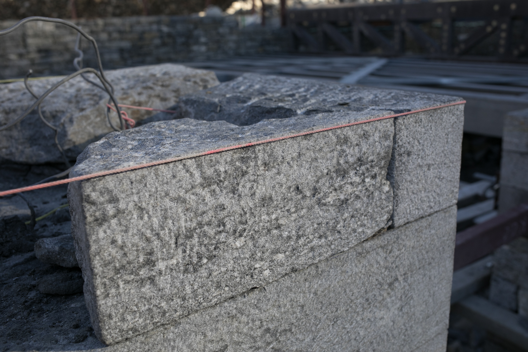
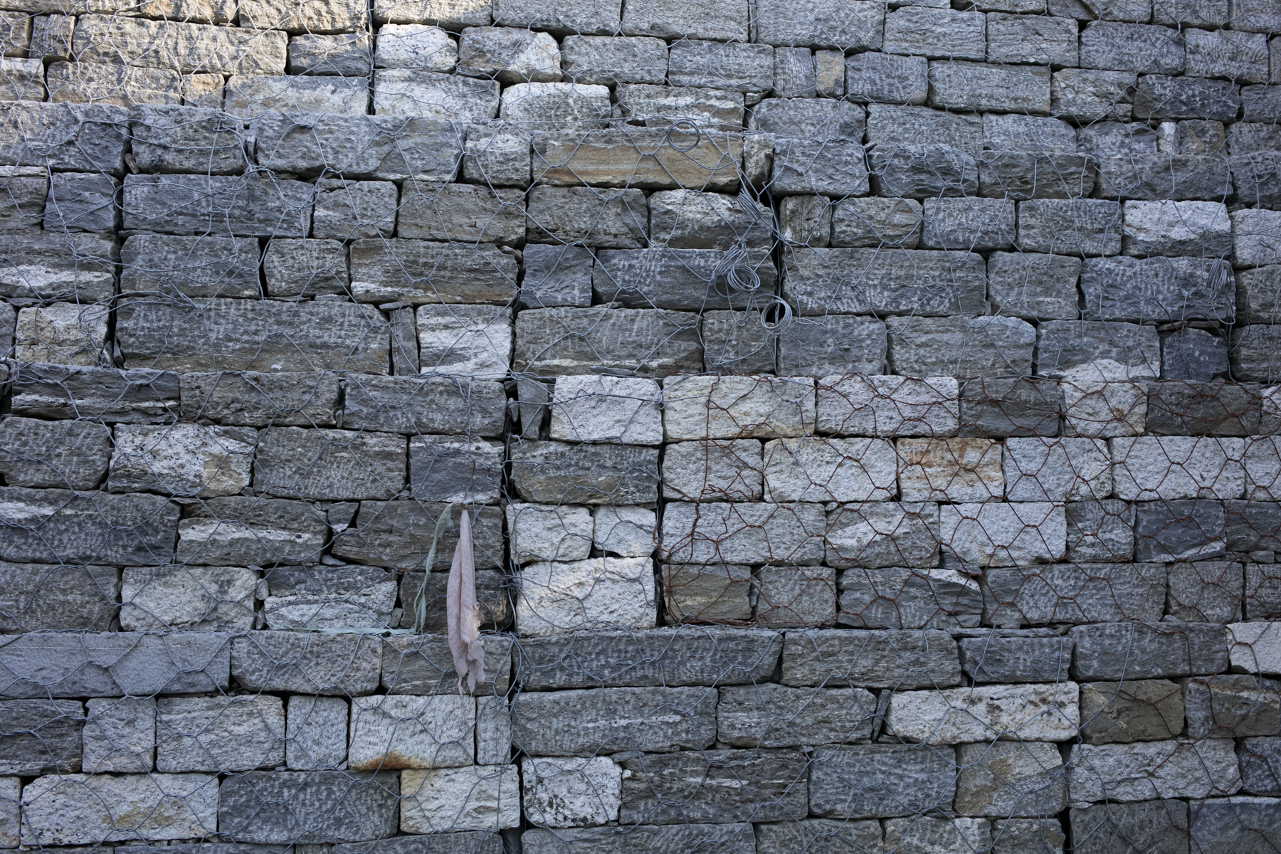
The stone masons of The Khumbu Climbing Center. Phortse is the location of the Khumbu Climbing Center. The village population is 250 individuals, 80 of who work on Everest, with 73 people who have summited. Two local families donated the land for the Climbing Center and The Alex Lowe Charitable Foundation raised money to help build the school. The Climbing Center will provide a space where Sherpa instructors and Nepal instructors can teach climbing technique.

Brandon Lampley works as a project manager for the Climbing Center but stresses the importance of having the people of Nepal build this space. We ran into Brandon while eating dinner and struck up a conversation about the project he was working on. He spoke passionately about the community in Phortse and his dedication to the workers who were building The Khumbu Climbing Center. The center will continue the ongoing climbing education in the Khumbu Valley. A philosophy I loved speaking to Brandon about was bringing in the tools and resources to a community and asking what you could do for them, rather than stating what he felt needed to be done. He spoke about focusing efforts on supporting Sherpa and Nepal instructors and helping the village by bringing students to stay with the community.


Phortse to Namche Bazzar

Stupa aged by the wind and winters stands at the edge of Phortse. In the background, you can see Cho Oyu, the sixth highest mountain in the world. Cho Oyu, China, 8,201 m / 26,906 ft. (Peakfinder).

Phortse with Ama Dablam.

Yak along the trail to Phortse.

Ambrose and Russ.

Taboche 6,495 m / 21,309 ft, Mount Everest 8,848 m / 29,029 ft, Lhotse Shar 8,382 m / 27,500 ft, Shartse 7,457 m / 24,465 ft, Ama Dablam 6,856 m / 22,493 ft, Thamserku 6,623 m / 21,729 ft, Kusum Kangguru 6,367 / 20,889 ft. (PeakFinder)
Namche Bazzar to Lukla

Koshi Nadi river. We hiked through Namche and on to Lukla. We made good time, moving along familiar landscape. As we approached Lukla the crowds grew and we began to see more developement. I stuck to the river, watching the cold water flow from Everest.

Prayer flags near the Koshi Nadi river.

Ambrose enjoys a final moment watching the mountains as we fly from Lukla to Khatmandu.
Many thanks to my fantastic travel companions. I couldn't have asked for a better group of guys to trek with. Thanks for the support, encourageent, and laughter.

Rusty Southwood

Lakpa Sherpa

Ambrose Bittner
My trip was organized by Ambrose Bittner and his wife Irene Wong. If you would like to learn more about the treks they organize please visit their business page using the button below.